


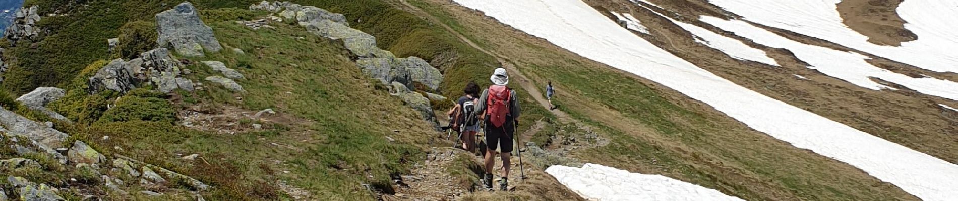
Aiguillette des Houches

janussity
User
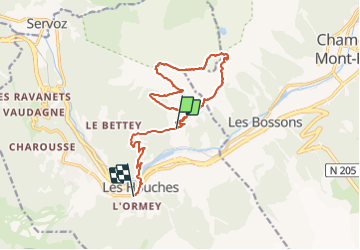

Length
15.2 km

Max alt
2303 m

Uphill gradient
1055 m
Km-Effort
30 km

Min alt
975 m

Downhill gradient
1411 m
Boucle
No
Creation date :
2021-06-26 07:18:09.171
Updated on :
2021-06-26 15:28:03.784
5h07
Difficulty : Difficult

FREE GPS app for hiking
 SityTrail
IGN / Geographical institutes
SityTrail Plus
The world is yours!
About
Trail Walking of 15.2 km to be discovered at Auvergne-Rhône-Alpes, Upper Savoy, Les Houches. This trail is proposed by janussity.
Description
Beau temps et vue extra sur Mt Blanc.
Retour voiture aux Houches inclus dans le circuit.
Photos


Positioning
Country:
France
Region :
Auvergne-Rhône-Alpes
Department/Province :
Upper Savoy
Municipality :
Les Houches
Location:
Unknown
Start:(Dec)
Start:(UTM)
330259 ; 5085884 (32T) N.
Comments